

NASA’s 6 new Earth Venture campaigns launch this summer, starting with INSPYRE
Six suborbital aircraft missions will map wildfires, pollution, glacier retreat, and landslide risk using airborne sensors.
NASA is gearing up six new Earth Venture suborbital campaigns, with INSPYRE taking the first science flights this summer. The program will mobilize hundreds of scientists and pilots across NASA, the U.S. Navy, universities, and other institutions over the next several years.
NASA is about to put six new Earth Venture suborbital campaigns into motion, and the first one is already set to take the skies this summer. The lead project for those initial science flights is the Injected Smoke and PYRocumulonimbus Experiment (INSPYRE), led by the Naval Research Laboratory, chasing the hardest kind of severe weather: fire clouds. When extreme wildfires burn hot enough to brew their own thunderstorms, they can produce towering pyrocumulonimbus clouds that create blind spots for aviators, generate lightning, and even spark new fires.
That matters far beyond “cool science.” NASA plans to run aircraft missions that can measure and map these wildfire-generated storms as they develop, including several flights using NASA’s high-altitude ER-2 out of Montana. The goal is forecasting improvement in the future. It is basically the difference between reacting after the sky turns ugly and getting ahead of it while the storm is still forming.
INSPYRE is one of several missions showing how NASA is using suborbital platforms as a bridge between ground instruments and satellites. The underlying idea is straightforward: satellites are great at coverage, ground sensors are great at precision, but the messy middle is often where forecasting and operational decisions live. Airborne remote sensing, using aircraft, helicopters, drones, and balloons, can fill in gaps in computer models used by weather forecasters, city planners, and others. Over the next several years, NASA expects the six projects to mobilize hundreds of scientists and pilots from NASA, the U.S. Navy, universities, and other institutions.
In the wildfire thread, the mission will carry a large suite of instruments over the wildfire-generated storm systems, including two state-of-the-art infrared wildfire trackers developed at NASA’s Jet Propulsion Laboratory (JPL) in Southern California and flying as part of NASA’s FireSense program. That detail is a big deal operationally. Infrared wildfire tracking is about seeing heat signatures when smoke, terrain, and storm dynamics scramble what you can observe with visible cameras alone. NASA also cites imagery captured over Utah and Colorado by the GOES-18 satellite in early July 2026, showing pyrocumulonimbus clouds crackling with lightning. So the mission is not starting from theory. It is responding to something that has already shown up in satellite observations.
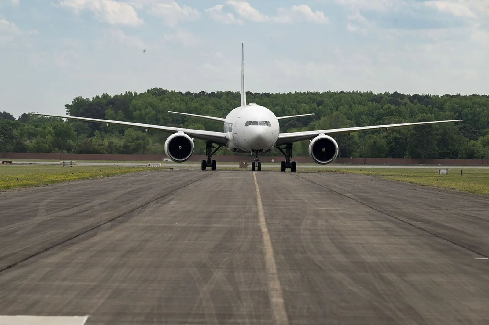
The second campaign opening this year, FarmFlux, pivots from storms to what rises from farmland and animal operations. Agricultural emissions are called out as important and understudied in Earth’s land and atmosphere systems, with effects on human health, global climate, and stratospheric ozone. FarmFlux will deploy more than a dozen sensors to measure ozone, methane, ammonia, particulates, and other pollutants rising from agricultural lands and animal farms stretching from the Midwest to California’s Central Valley. This mission is led by NASA’s Goddard Space Flight Center in Greenbelt, Maryland, along with Colorado State University and Boston University. It also uses the agency’s 777 aircraft, transformed into a flying laboratory through structural modifications like enlarged cabin windows and instrument portals, gearing up to start science flights.
Next up are air quality missions that look at how two very different cities get smoky for different reasons. Hemispheric Airborne Measurements of Air Quality (HAMAQ) will investigate areas of poor air in Atlanta and Mexico City, and it will test how satellite information can support forecasting and mitigation efforts. The plan is to deploy two aircraft at different altitudes. NASA’s P-3B will fly close to the surface to directly measure fine particle and gaseous pollutants, while the recently acquired 777 science jet will map pollution with remote sensors from higher up. NASA’s Langley Research Center in Hampton, Virginia is leading the mission. The strategic point for decision-makers is that altitude is not a technical footnote. It changes what you can see, how you interpret it, and what interventions might work.
From there, NASA’s Arctic-focused campaigns aim at the physics of change, where timing matters and the feedback loops can get brutal. The Snow4Flow campaign, led by the University of Arizona, seeks to measure and model how far and fast glaciers are retreating in the far north. Teams will traverse remote icescapes across Alaska, the Yukon, Arctic Canada, Greenland, and Svalbard, Norway, flying in a modernized WWII-era aircraft outfitted with a scanning laser altimeter and two custom radars. Their observations, combined with satellite data and advanced models of snowfall and glacier flow, are meant to advance understanding of how glaciers behave in different regions of the Arctic.
Alongside that, FORTE, led by NASA Goddard and the City College of New York, studies how thawing permafrost and landscape shifts change river and near-coastal processes. The project focuses on rivers, lagoons, and estuaries across Alaska’s North Slope and how they interact with the Arctic Ocean. It will combine optical and radar measurements from satellites, planes, high-tech research vessels, drones, and underwater autonomous systems to track microscopic marine life, water flow, and chemistry. Importantly, the mission will collaborate with local and tribal communities to sustain observations over time and apply NASA assets to emerging local decision-making priorities.
Finally, the Landslide Change Characterization Experiment (LACCE) tackles hazards that can swing from slow to catastrophic. NASA points back to a 2017 event where a slow-moving landslide in California collapsed and buried a section of coastal highway. JPL wanted to understand how precipitation swings contributed to destabilization, studying how water infiltrates hillslopes worldwide. LACCE will combine airborne synthetic aperture radar with land-based sensors to track how slopes in California respond to intensifying droughts and downpours. The project also aims at Alaska’s emerging landslide hazards, where rapidly retreating glaciers are accelerating slope movements with potential to create mega-tsunamis.
The Earth Venture Suborbital program itself is designed to be nimble and high impact. It was established following a recommendation by the National Research Council in 2007, and in the decades since it has supported studies including blizzards, coral reefs, and ocean whirlpools. For executives and boards looking at the broader “why now,” this is a clear signal: public science programs are increasingly shaped like platforms, stitching together sensors, aircraft, satellites, and models to produce actionable data. The second-order stake is that better measurement pipelines can shift what governments, insurers, aviation operators, and infrastructure planners decide next, long before a problem becomes a headline.
This story's Key Insights and Take-aways are locked.
Create a free account to unlock Executive Actions for one credit.
Register to UnlockAlways free for Executives Club members. Join the Club
More in Science
2026 Nikon Small World Winners Reveal the Hidden Machinery of Everyday Life
A mycologist's frozen Edinburgh garden became the backdrop for vivid views inside cells, a reminder of what advanced imaging now makes visible to researchers and the industries built on biology.

Study: 1 in 4 depression cases may be a body-clock problem, not a chemical one
A 10,000-person study finds standard antidepressants often fail these patients, but melatonin and morning sunlight may hit the real root cause.

Start-Up Says A.I. Designed a Virus to Attack One Patient's Superbug
If the claim holds up, personalized phage therapy could become a new frontline weapon against antibiotic resistance - but proof is far from final.