
NASA’s PACE ocean satellite catches wildfire smoke, and it spots burn scars too
An ocean-focused hyperspectral mission is turning into a new wildfire intelligence tool, right from space.
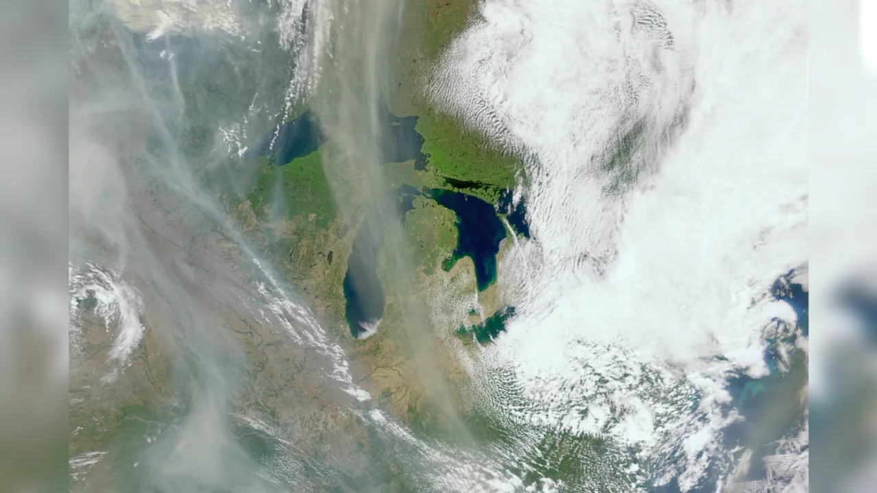
NASA's PACE (Plankton, Aerosol, Cloud, and ocean Ecosystem) satellite, built to study Earth's oceans and atmosphere, captured wildfire smoke swirls over Canada with its Ocean Color Instrument. For decision-makers, this expands the practical reach of hyperspectral satellite data from oceans to fast-moving wildfire impacts.
Wildfire smoke over the Great Lakes in Canada is not usually something you connect to an ocean-monitoring spacecraft. But NASA's PACE (Plankton, Aerosol, Cloud, and ocean Ecosystem) satellite did exactly that. The photo, snapped in May of last year, shows gray smoke wisps drifting from massive wildfires rippling through North America, with fluffy white clouds floating over land and lakes. The twist is that PACE was not designed with wildfire tracking as its explicit mission.
In this image, the wildfire signal is coming through PACE's Ocean Color Instrument, which uses “hyperspectral” imaging. That means it observes Earth in hundreds of different wavelengths of light, spanning visible, near-infrared, and ultraviolet. In practical terms, the satellite is not just taking a picture. It is collecting a detailed spectral fingerprint for what is in the atmosphere and on the ground, and wildfire smoke is one of the things it can detect.
This matters for anyone who has ever had to make decisions during a smoke event, manage environmental risk, or plan response under uncertainty. Wildfires are fast, messy, and multi-factor. You are not only dealing with fire location. You are dealing with smoke transport, atmospheric conditions, and what the land looks like after the burn. The source points out that the PACE spacecraft is built for oceans and atmosphere monitoring, yet its hyperspectral dataset is proving versatile. “The PACE satellite observes land too, and does it really well,” Skye Caplan, terrestrial lead for the PACE mission at NASA's Goddard Space Flight Center in Maryland, said in a statement. Caplan added, “There is so much to explore with a new hyperspectral data set.”
If you are wondering why “hyperspectral” is a big deal, here is the simple version: more wavelengths can reveal more types of information. The PACE Ocean Color Instrument can spot changes in vegetation, burn scars, and the charred aftermath of a wildfire. Because different materials and conditions reflect and absorb light differently across wavelengths, the instrument’s hundreds of bands can help distinguish stressed or dry plants, and even how pigmented they are. That can translate into more than just damage documentation. The source notes it could help identify dry areas that might carry a higher risk of wildfires igniting.
Now, zoom out from the beautiful satellite image and look at the operational reality. Wildfire monitoring is typically a patchwork of sources: ground reports, aircraft when available, ground-based air-quality sensors, and satellite systems targeted for specific tasks. When a single mission designed for another purpose starts reliably capturing wildfire smoke and post-fire surface changes, it effectively adds another “lens” to the existing toolkit. For agencies and organizations coordinating preparedness and response, that can reduce blind spots. For companies operating in fire-prone regions, it can sharpen risk visibility and inform planning around air quality exposure, supply chain disruptions, and land management decisions.
There is also an ecosystem and governance angle, even if the story is about science. NASA mission data often ends up feeding downstream users: researchers, environmental analysts, and practitioners who build models and alerting workflows. While the source does not discuss specific regulatory changes, it does underline a pathway: hyperspectral datasets can be “incredibly helpful” in deepening understanding of wildfires and how they spread. Better understanding can influence how policies are framed, how resources are allocated, and how thresholds for action are determined, especially when smoke affects public health and transportation, and post-fire landscapes drive longer-term ecological and infrastructure impacts.
Second-order implications for boards and executives follow fast. If wildfire intelligence improves, the cost of being wrong goes up, because stakeholders will increasingly expect your decisions to reflect the best available data. That includes insurers and risk managers who underwrite exposure, utilities and telecom operators who manage assets in high-risk corridors, and land-intensive businesses that need to understand where burn scars and stressed vegetation are forming. PACE’s ability to observe land too, “and does it really well,” suggests hyperspectral ocean-atmosphere technology is not confined to one category of reporting. It can become a multi-purpose monitoring asset.
The bottom line: PACE is a real example of how spacecraft designed for one job can end up solving another. In this case, an ocean-focused hyperspectral instrument is catching wildfire smoke swirls over the Great Lakes and detecting burn scars and charred aftermath. For decision-makers, that means the intelligence pipeline around wildfire events may be about to get richer, faster, and more spatially detailed than many teams expect from a mission that sounds, on paper, like it belongs to plankton and clouds.
This story's Key Insights and Take-aways are locked.
Create a free account to unlock Executive Actions for one credit.
Register to UnlockAlways free for Executives Club members. Join the Club
More in Science
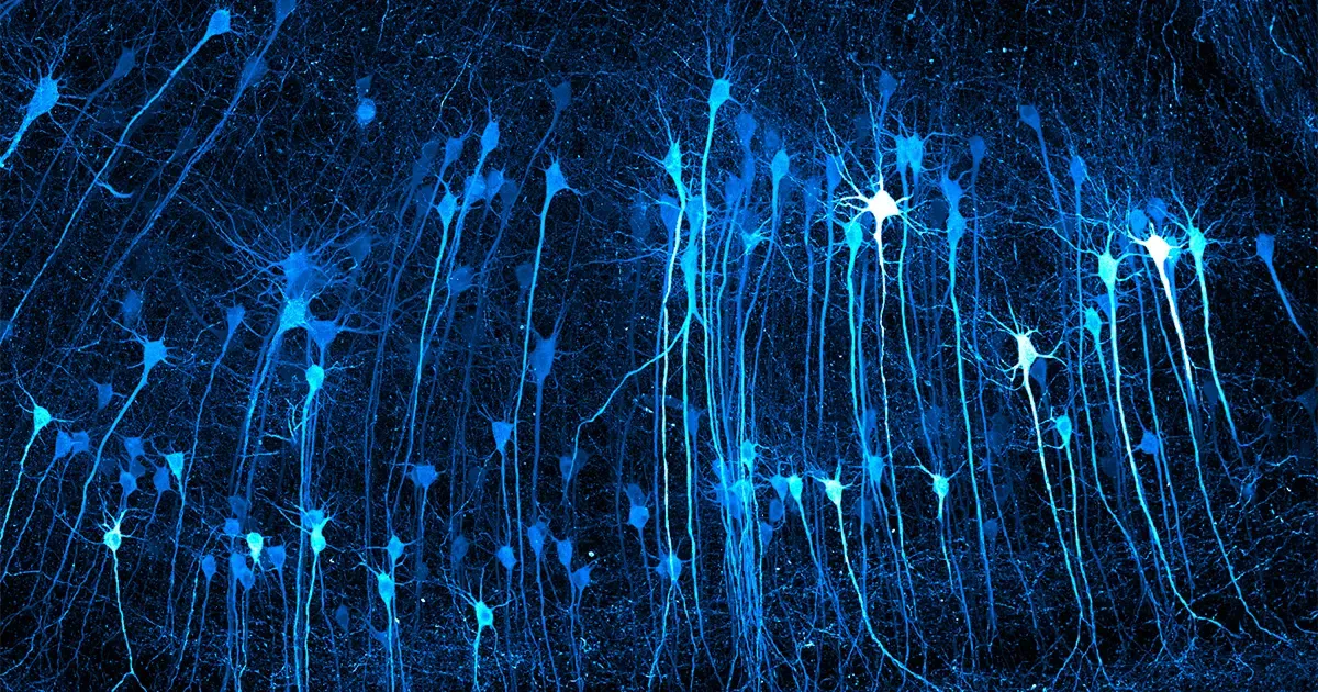
2026 Nikon Small World Winners Reveal the Hidden Machinery of Everyday Life
A mycologist's frozen Edinburgh garden became the backdrop for vivid views inside cells, a reminder of what advanced imaging now makes visible to researchers and the industries built on biology.

Study: 1 in 4 depression cases may be a body-clock problem, not a chemical one
A 10,000-person study finds standard antidepressants often fail these patients, but melatonin and morning sunlight may hit the real root cause.

Start-Up Says A.I. Designed a Virus to Attack One Patient's Superbug
If the claim holds up, personalized phage therapy could become a new frontline weapon against antibiotic resistance - but proof is far from final.